
Satellite Receiving
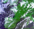
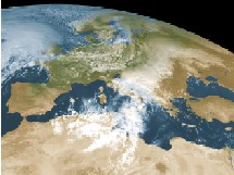
Meteorological satellites are among the most important sources of information for weather forecasting, atmospheric monitoring and tracking cloud systems, precipitation, storms, dust, smoke and climatic phenomena on a regional and global scale. Using sensors installed in space, vast areas can be observed continuously, providing information that cannot be collected by a single ground-based weather station.
To use the information transmitted by satellites, a meteorological receiving station is required, comprising an antenna, a receiver, a tracking system, a computer and software for processing and displaying the data. The station receives the digital transmissions, converts them into usable information and makes it possible to display satellite images, cloud layers and additional meteorological data.
Meteo-Tech supplies a station for receiving digital transmissions from meteorological satellites, designed for forecasting bodies, research centers, meteorological services, academic institutions, airports, government agencies, emergency response organizations and any organization that needs up-to-date meteorological information from space.
What Is a Meteorological Satellite?
A meteorological satellite is a satellite equipped with sensors that measure or image phenomena occurring in the atmosphere and on the Earth's surface. It collects information on clouds, temperatures, humidity, radiation, the sea surface, land, snow, ice and other environmental phenomena.
The information is transmitted from the satellite to ground stations, where it is received, decoded and displayed as an image or a data product. It can then be combined with data from weather radar, weather stations, radiosondes, numerical models and other sensing systems.
Satellite data provide an exceptionally wide spatial picture. While a ground station measures conditions at a specific point, a satellite can observe weather systems covering entire countries, seas and continents.
How Does a Meteorological Satellite Receiving Station Work?
A satellite receiving station is designed to receive the signals transmitted by satellites and convert them into data that can be analyzed and displayed.
The workflow typically includes the following stages:
- The satellite measures or images the atmosphere and the Earth's surface.
- The data are encoded and transmitted to the ground.
- The station antenna receives the signal.
- The receiver filters and decodes the digital transmission.
- Dedicated software processes the information.
- The data are displayed as images, maps, spectral channels and meteorological products.
- The user can save, analyze and distribute the data to other systems.
Depending on the type of satellite, the station may include a fixed antenna or an antenna capable of tracking the satellite's movement across the sky.
Types of Meteorological Satellites
Geostationary Satellites
A geostationary satellite is in an orbit in which it appears to remain above the same point relative to the Earth. This position allows it to observe the same region continuously and provide images at a high frequency.
Satellites of this type are particularly suitable for:
- Continuous tracking of cloud systems
- Monitoring storm development
- Tracking weather fronts
- Detecting dust storms
- Tracking smoke from wildfires
- Monitoring cloud cover in aviation areas
- Short-range weather forecasting
- Rapid detection of atmospheric changes
The main advantage is a high update rate. You can see how a weather system develops and moves over time rather than relying on a single image.
Polar-Orbiting Satellites
Polar-orbiting satellites circle the Earth at a lower altitude and pass over different regions on each orbit. Over the course of a day they can cover very large parts of the globe.
Their relative proximity to the surface usually makes it possible to obtain data at a higher spatial resolution than geostationary satellites.
These satellites are used for:
- Measuring sea surface temperature
- Cloud mapping
- Tracking snow and ice
- Vegetation monitoring
- Climate research
- Fire detection
- Measuring atmospheric profiles
- Ocean research
- Tracking environmental change
Combined Satellite Systems
In forecasting and research operations, it is common practice to combine data from geostationary and polar-orbiting satellites. The geostationary satellite provides a continuous, high-frequency stream of observations, while the polar satellite provides more detailed measurements whenever it passes over the region.
This combination provides a more complete picture of the atmosphere and the Earth's surface.
What Data Can Be Obtained from Meteorological Satellites?
A suitable receiving station can provide access to various types of data, depending on the satellite, its sensors and the transmission format.
The data may include:
- Visible-light cloud imagery
- Infrared imagery
- Water vapor imagery
- Cloud-top temperature
- Sea surface temperature
- Land surface temperature
- Location and movement of cloud systems
- Dust storm detection
- Smoke detection
- Fire hotspots
- Snow and ice cover
- Atmospheric humidity
- Temperature profiles
- Vegetation indices
- Precipitation estimates
- Movement of weather fronts
- Storm development
- Radiation at different wavelengths
Not every station receives every type of data. The receiving system must be matched to the desired satellites, the frequency range, the transmission format and the user's professional applications.
Imaging and Measurement Channels on Meteorological Satellites
Visible Channel
The visible channel provides an image similar to an ordinary photograph of the Earth. It makes it possible to distinguish clouds, land, sea, snow, ice, smoke and dust when lighting conditions are suitable.
This channel is especially useful during daylight hours for identifying cloud structure, tracking fog, detecting dust and smoke, distinguishing between sea and land, and analyzing local phenomena.
At night, reflected sunlight is not available, so infrared and other channels are used instead.
Infrared Channel
Infrared sensors measure thermal radiation emitted by clouds, land and sea. These measurements make it possible to estimate the temperature of the observed surface.
High, cold clouds usually produce a different signal from low, warm clouds. This makes it possible to estimate cloud-top height and to track storm clouds even at night.
Water Vapor Channel
The water vapor channel provides information on the distribution of moisture in different layers of the atmosphere. It helps identify moist and dry regions, upper-level air currents, troughs, ridges and processes associated with weather development.
Additional Spectral Channels
Advanced meteorological satellites carry sensors that operate across a large number of wavelengths. Combining channels makes it possible to identify phenomena that cannot always be distinguished in a single channel.
Channel combinations can be used for:
- Distinguishing between cloud and snow
- Detecting desert dust
- Detecting volcanic ash
- Locating fog
- Detecting smoke and fires
- Estimating cloud height
- Temperature analysis
- Monitoring the sea surface
- Identifying vegetation and environmental changes
Using Satellites for Weather Forecasting
Forecasters use satellite data to monitor the state of the atmosphere, identify weather systems and assess how they develop.
The data make it possible to track:
- Incoming weather fronts
- Development of low-pressure systems
- Cloud movement
- Thunderstorm development
- Rain systems
- Fog
- Haze and dust
- Jet streams
- Upper-level humidity
- Cloud development over the sea
- Changes in the synoptic pattern
Satellite observations make it possible to identify a system even before it reaches the area where ground stations operate. This gives forecasters additional time for analysis and preparation.
Cloud and Storm Monitoring
One of the main uses of meteorological satellites is tracking the development of clouds and storms.
Repeated images make it possible to identify:
- The onset of storm cloud development
- Rapid growth in cloud height
- Movement and rotation of cloud systems
- Development of squall lines
- Cold cloud tops
- Weakening or intensification of a system
- Cloud cover moving into a specific area
When satellite data are combined with weather radar and lightning measurements, a more accurate picture of a storm's intensity, location and direction of movement can be obtained.
Detecting Dust Storms and Haze
Dust storms are a significant phenomenon in Israel and the Middle East. Dust particles can travel great distances, reduce visibility, degrade air quality and affect aviation, transportation, public health and solar energy systems.
By processing spectral channels, dust clouds can be identified and the following can be tracked:
- The source region
- The direction of transport
- The spread of the dust cloud
- Its arrival over populated areas
- The relationship between the dust and wind systems
- The duration of the event
- Gradual dispersion
- Movement over sea and land
Satellite data provide wide regional coverage and therefore complement measurements from air quality stations and aerosol lidar systems very well.
Monitoring Fires and Smoke from Space
Satellite sensors can detect hotspots and smoke layers. This information is used to track forest fires, fires in open areas and industrial incidents.
The data can help with:
- Detecting fire hotspots
- Tracking the spread of smoke
- Estimating the direction of plume movement
- Identifying areas that may be affected
- Supporting emergency response operations
- Tracking regional events
- Assessing the impact on air quality
- Documenting events for research purposes
Meteorological Satellites for Aviation
Satellite information is important for aviation planning and management, especially in areas where ground station coverage is limited.
Satellites help identify and track:
- High-level cloud cover
- Storm clouds
- Fog and low cloud
- Dust storms
- Smoke
- Volcanic ash
- Weather systems along flight routes
- Upper-level humidity and airflows
- Conditions over the sea
- Rapid changes in the weather
At airports and aviation forecasting centers, satellite data are combined with weather stations, radar, ceilometers, visibility sensors, lightning detectors and meteorological models.
Using Satellites in Climate Research
Meteorological satellites make it possible to build long data records of the atmosphere, the oceans and the land. Researchers use these data to examine climate trends and environmental change.
Research applications include:
- Tracking sea surface temperature
- Changes in cloud cover
- Retreat of ice and snow
- Changes in vegetation
- Drought
- Changes in land surface temperature
- Storm frequency
- Extreme heat events
- Changes in the radiation balance
- Movement of aerosols and dust
- Tracking desertification
The advantage of satellite information is the ability to compare vast areas using a relatively uniform measurement method.
Combining Satellite Data with Weather Stations
A satellite provides wide spatial coverage, while a ground station provides direct, local measurement of conditions at ground level.
Combining the two sources makes it possible to:
- Validate satellite data
- Compare spatial observation with point measurement
- Improve the analysis of weather systems
- Identify local conditions that are not clearly visible from space
- Improve meteorological models
- Analyze precipitation and cloud cover
- Estimate surface temperatures
- Identify dust, smoke or fog events
A weather station can measure temperature, humidity, wind, rainfall, pressure and radiation, while satellite data provide the regional context in which the station is located.
Integrating Satellite Data into Weather Forecasting Models
Numerical weather prediction models require the most accurate possible description of the state of the atmosphere at the starting point.
Satellite data can be used in the data assimilation process to improve estimates of:
- Temperature at different altitudes
- Atmospheric humidity
- Sea surface temperature
- Cloud cover
- Radiation
- Winds
- Land surface conditions
- Snow and ice
The more accurate and comprehensive the initial information, the better the model's ability to predict how the system will develop.
Components of a Satellite Receiving Station
A complete receiving station may include several components, depending on the satellites and the application.
Antenna
The antenna receives the transmission from the satellite. The antenna's size, design and frequency range are determined by the type of transmission and the signal strength.
Tracking System
When receiving a satellite that is not fixed relative to the station, its path across the sky must be tracked. The tracking system moves the antenna according to the satellite's calculated position.
Satellite Receiver
The receiver takes the signal from the antenna, filters it and converts it into digital data that can be transferred to a computer.
Processing Computer
The station computer runs the reception software, stores the files and processes the data. Computer requirements depend on the volume of data, the reception rate and the types of products generated.
Reception and Processing Software
The software manages the reception process and displays the data. It may include tools for image display, channel combination, animation, archiving, export and analysis.
Communication and Storage System
A professional station may transfer the data to an organizational network, a forecasting center, a server or an archive system. Adequate storage capacity and a communication rate sufficient for data transfer must be planned.
How to Choose a Satellite Data Receiving Station?
Which satellites do you want to receive?
Define whether reception is required from geostationary satellites, polar-orbiting satellites or both types.
Which frequencies and formats are required?
Make sure the antenna, receiver and software support the frequency range and transmission format of the required satellites.
Is direct reception required?
In some applications, data can be obtained over the internet or through a distribution service. In other cases, direct and independent reception at the local station is important.
Direct reception can provide:
- Operational independence
- Fast data delivery
- Control over the reception process
- Access to raw data
- Continued operation even when an external service is unavailable
- Compatibility with operational systems
Resolution and Update Rate
Define the required spatial resolution and how frequently images and data must be received.
Short-range forecasting may require a high update rate, while climate research may place greater emphasis on stability, archiving and data continuity.
Processing and Storage Requirements
Satellite data can generate large volumes of information. Plan for:
- Storage space
- Backup
- Processing speed
- Archiving
- Information security
- Data distribution
- Interfaces to external systems
Installation Site Conditions
Examine the antenna's field of view, electromagnetic interference, wind and rain conditions, salinity, dust, maintenance access and lightning protection.
The Advantages of a Local Receiving Station
A local receiving station enables an organization to receive information directly from the satellite and reduce its dependence on external data sources.
The main advantages include:
- Independent access to data
- Receiving information within a short time
- The ability to store raw data
- Processing tailored to the organization's needs
- Integration into a local forecasting system
- Building an independent archive
- Research support
- The ability to distribute information to authorized users
- Continuous operation, subject to satellite and station availability
The value of the station is especially high when the data are used for operational, research or mission-critical activities.
Installing a Meteorological Satellite Receiving Station
Correct installation is important for maintaining reception quality and system availability.
Issues to address include:
- An open field of view toward the satellites
- Distance from tall buildings
- Preventing interference from antennas and transmission sources
- Robust mechanical infrastructure
- Wind resistance
- Grounding
- Lightning protection
- Sealing and resistance to outdoor conditions
- A stable power supply
- Backup power
- Data communication
- Safe access for maintenance
- A suitable location for the computer room
In systems with a tracking antenna, make sure there are no objects restricting its range of motion.